I had just bought myself a new pair of waterproof low hiking boots and I needed to try them out.
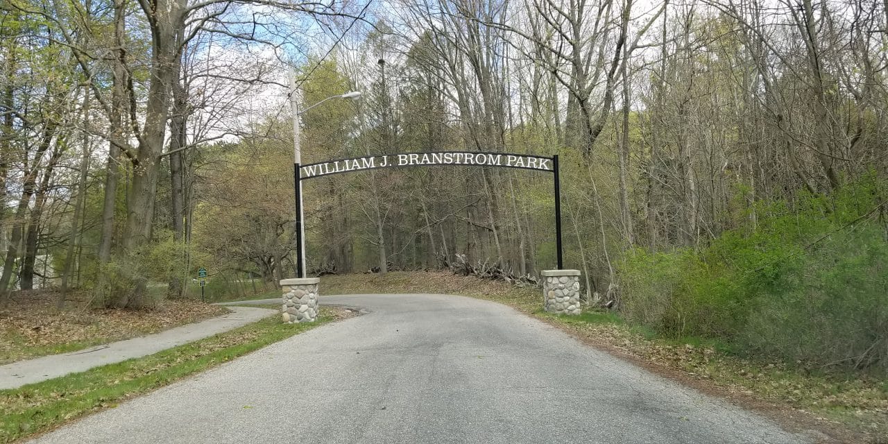
If you live or work in Fremont, or if you’re vacationing in the area and stop there for supplies or to grab something to eat, do yourself a favor and do not overlook Branstrom Park. This beautiful 100 acre piece of paradise was donated by attorney William J. Branstrom. I know what you’re thinking; a park, in the city… can’t be that great. Well, you’d be oh-so-wrong.
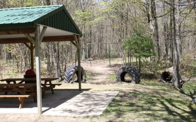
First of all, the park is very easy to find. Simply head north on Darling off Main Street in downtown Fremont and in a few blocks, you’ll come to the entrance. I like to use the lower parking lot, on your immediate on your left after you enter. There’s a nice playground and huge pavilion there and this is also where you’d go to access the park’s Disc Golf Course. That a blog for another time, but suffice to say – it’s a really, really cool, albeit fairly difficult course.
If was a cool Friday in May, a mere 48 degrees out, but I needed to try these new hiking boots and Branstrom is only a 5 minutes drive my office, so I went over during my lunch hour. I’m very comfortable in the woods, and in my opinion, the park isn’t large enough to get lost in, but if you’re less comfortable, I’ll give you the lay-of-the-land. I’ll be traveling the park counter-clockwise.
After parking, I headed roughly north over a little footbridge, up a hill and got on a paved section of sidewalk. I could see a few guys playing disc golf off to my left, which is a good reminder that the course runs through the park, so it’s a good idea to stay alert in the off-chance an errant Frisbee heads your way. You’re not on pavement very long before taking the first trail that veers off to your left. This section of the trail is wide… about as wide as a 2-track. The trails are marked, but it can be tempting to get off track. If you see a side trail and it leads to a post, that’s probably a disc golf tee box.
After a bit, you’ll go up a gradual slope and find a bench with a little shade roof over it on your right and a split in the trail. The main trail goes straight, through the center of the park and avoids some of the largest hills. I veered left because I love hills and wanted to give the new boots more of a trial. This route will take you down to the gully, where you’ll take a little footbridge over the small stream that runs through the park. This is a beautiful spot for a photo. The next section is probably the most challenging, as it involves, first a very steep uphill climb, followed by a much longer, but significantly less steep one. The biggest reason I usually take the trail counter-clockwise is this particular hill. I’m not that old, only 52, but as my dad always used to say; “it’s not the years, it’s the miles,” and my knees have a LOT of miles on them. Going uphill is much easier on them then doing down.
Taking this trail brings you to the edge of the park, and you can make out the fields of local farms through the trees. The trails winds its way around through a particularly pretty section towards the back end, before twisting around and heading back over the stream on another footbridge. At this point, this trail meets back up with the main one. Go right, and head back out for a very short hike, or like I did, head left and keep exploring. This section of the trail goes a bit further back to the north end of the park before turning south again and intersecting the only paved road that runs through the park. Simply hike south by south-east along the road for about a hundred yards and pick up the trail again on your left heading roughly west.
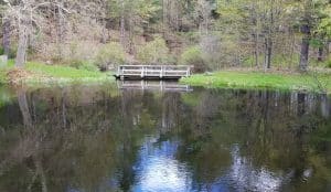
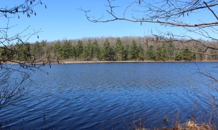
Once you do, you’ll pass the tee-box for the 12thhole of the disc golf course, and if you stay left there, you’re back on the trail. Most of the arrows you’ll see on trees in this section are for the Fremont High School Cross Country track. The arrows will direct you right at the next trail intersection, but you’ll want to stay left. The trail will cross the road again going north, before looping back around to cross it one more time heading south. You’ll be up on ridge for a while here with nice views of a small lake off to your left. You’ll pass two more tee boxes (#13 and 14) for the disc golf course before heading down a hill to your left.
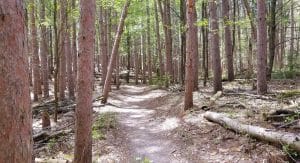
At the bottom of this hill, go right. In a little while, you’ll cross a wide open section of the lower part of huge slope, which is a GREAT place for sledding in the winter. Heads up, though, as there is another disc golf tee box at the top of the hill on your right that you won’t see until you’re well into the path of oncoming Frisbees! After crossing the open area on the slope of the hill, you’ll come into one of my favorite sections of the trail as it winds its way through a beautiful pine forest. You’ll also pass the only residence that boarders the trail. As it comes out of the pines, you’ll pass a marshy area on your left that deer frequently bed down in during the day. It was on this section of trail that I came upon something unique one early sparing day several years ago. It was a slimy, gelatinous glob right in the middle of the trail. Dumfounded, I took a photo of it, which my father later identified as an afterbirth. A doe had apparently dropped a fawn, right there in the middle of the trail not long before I came upon it. There’s a very good chance the tiny animal was laying, completely camouflaged mere feet away. Speaking of deer – It is not at all uncommon to see them on various parts of this trail, and if you keep your eyes open and your mouths shut, you’ll increase your odds of seeing them exponentially.
The last part of the trail includes a long slow uphill climb that loops around and includes a hairpin turn back to your left. Through here the trail runs parallel to the fairway of the final disc golf “hole” and ends with some timber and root steps back down to the parking area. This whole loop is a little less than a mile, and if you double it up and add the middle section, it’s very easy to get a nice, 2-mile hike in this park. Once on the trails, you’d never know how close you are to downtown Fremont, it feels that secluded and remote, which goes to show you – you don’t have to be miles from civilization to get a good hike in, in Newaygo County.
by Chris Kuebler
A Beginner’s Guide to Snowshoes and How to Use Them
By Samantha Breza Want to do something new this winter? Try snowshoeing! Snowshoeing is an easy sport to get into. The equipment is relatively cheap, snowshoers don’t have to register the equipment, or pay annual fees for it. Snowshoers don’t need to take classes or...
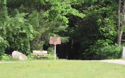
Ensley Township Nature Preserve
By Wendy Sinicki Tucked in the southeastern corner of Newaygo County is a wonderful place to spend time hiking, especially with the family. The Ensley Township Nature Preserve, 6985 136th Street, Sand Lake, just west of Cypress Avenue, is designed with children in...
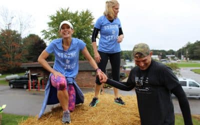
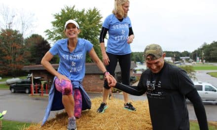
Are You Two Dam Tuff?
Are you Two Dam Tuff? It's a question that gets asked the first Saturday in October each and every year in Newaygo County. For those "in the know", The Croton and Hardy Dams are separated by about 6 miles as the crow flies, and are spectacular tourist draws in...

Campground Connector
The Campground Connector Trail is a 4.3-mile loop that can take local hikers from the campground through Forest Service lands where it connects with the National Trail and returns to the Campground. The hikers on the North Country Trail can take the Campground...
A Quaint Town & Country Path
Fremont has long been known as the Baby Food Capital of the World and attracts thousands of visitors to Gerber’s popular National Baby Food Festival in July. Visitors also come to enjoy Fremont’s Harvest Festival, nearby woods and lakes, and the Fremont Town...
Camp Newaygo & The Wetland Trail
Nature-seekers who discover the “Wetland Trail” at Camp Newaygo are treated to an ecologically-unique outdoor experience. The Wetland Trail is no ordinary swampland or run-of-the-mill hiker pathway! In fact, the one mile (roundtrip) boardwalk trail, is one of the only...
Newaygo Gets The Edge
As residents and visitors alike agree, Newaygo County has an enviable natural resource base that has to be experienced firsthand to be fully appreciated. 2014 brought the introduction of a new Newaygo County asset: The Edge! Ready to get away for an afternoon, an...